Hey there! Welcome back to my page. How are you all? I am good and expect the same from you.
Today I came up with a new topic which is going to be very interesting, informative and worth knowledge improving. It's quite familiar to everyone but I would like to describe it more deep. It's all about “Maps”. Yes you read right. Now a days, can you image your life without google maps?? No… right!??. So, have you ever wondered about the visual representation of the world in different ways?. You guys didn't get it? Let me tell you…
Maps provide visual representation of the world, revealing it's layout in variety of ways. Some maps depict earth's geographical features and other maps detail road routes, boundaries, aid navigation on urban transportation and keys explain map symbols.
Let's look at the different types of maps, what do they describe, availability etc.., in this article.
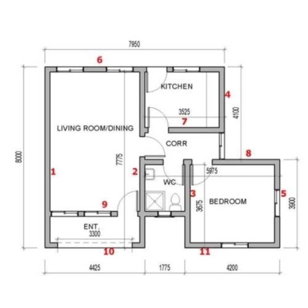
Building Plan: When planning to build a structure, engineers first map out the building. Details such as layout, walls, entrance, lifts, exit doors etc are marked to assist workers during the construction. Precise measurements are added to give true size of the project.
Building plan
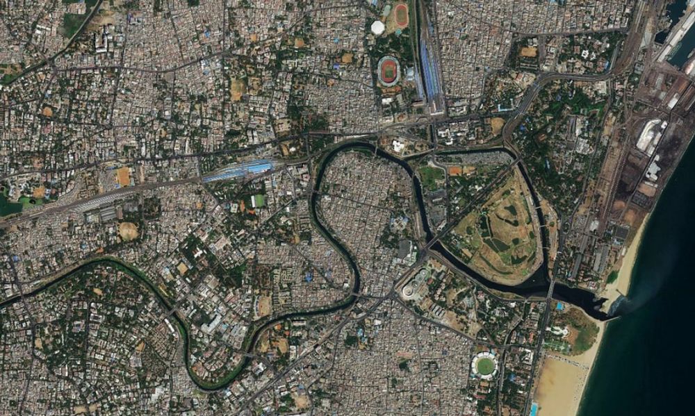
Satellite Image: Space satellites are used to photograph earth, capturing it's surface in great detail. Orbiting around the earth, in thousands of kilometre away, these satellites track the changes in the land, the ocean and the atmosphere.
Satellite map
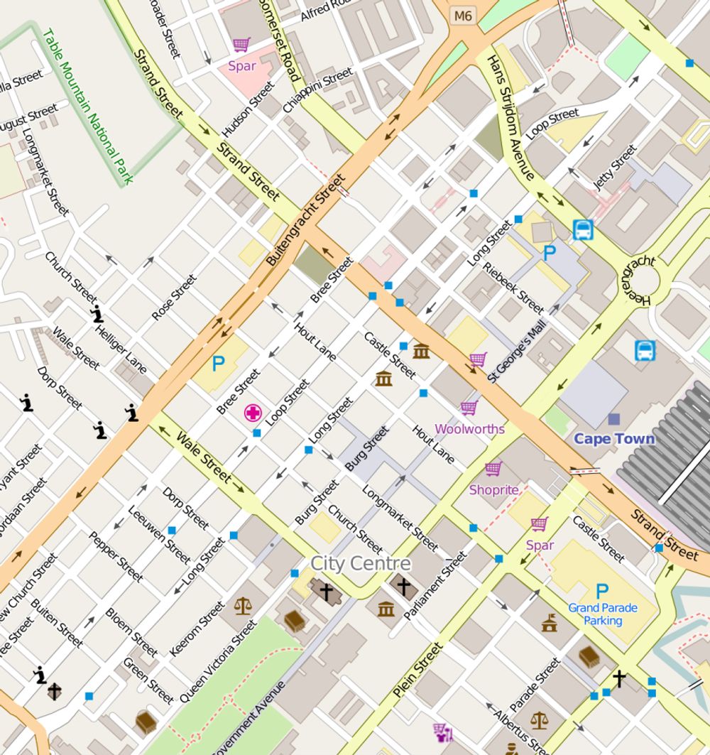
Street Map: Useful for navigating cities and towns. These maps include road names, notable landmarks such as hospitals, restaurants, railway stations, churches, temples, parks. Street maps are available online and via mobile phone.
Street map
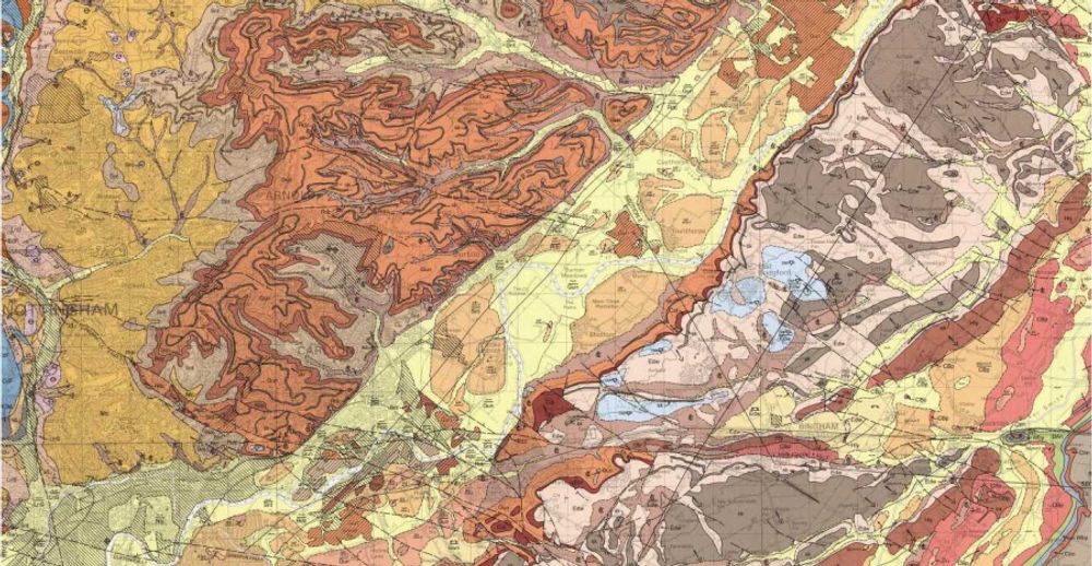
Geological Map: Different rock types are coded by colour on geological maps. Geologists study these maps to determine the location of minerals and oils, while engineers ensure rock types suit their construction plans before laying foundation.
Geological maps
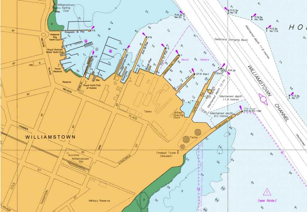
Sailing Chart: Nautical maps of coastal oor ocean areas are called charts. They include information about tides, currents, depths, potential hazard and features of the seabed. Sailors cary these charts on board their ships to help with marine navigate.
Sailing chart
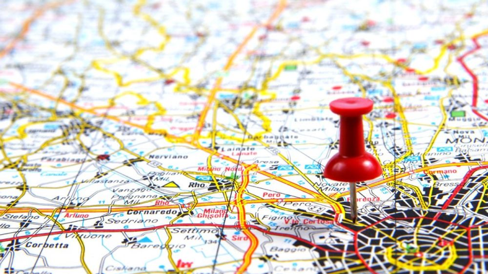
Road Map: This visual aid for road users is the most commonly used map of all. Covering a much larger area than a street map, road maps use different colours and lines to represent motorways, main road and country routes.
Road map
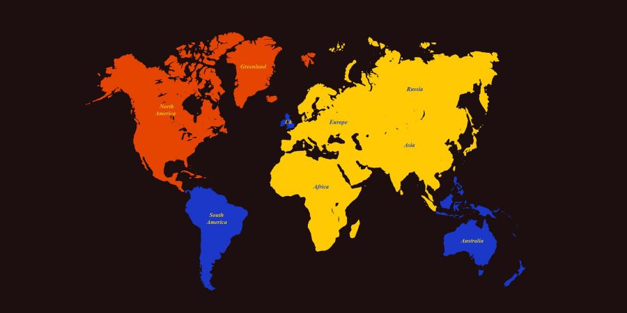
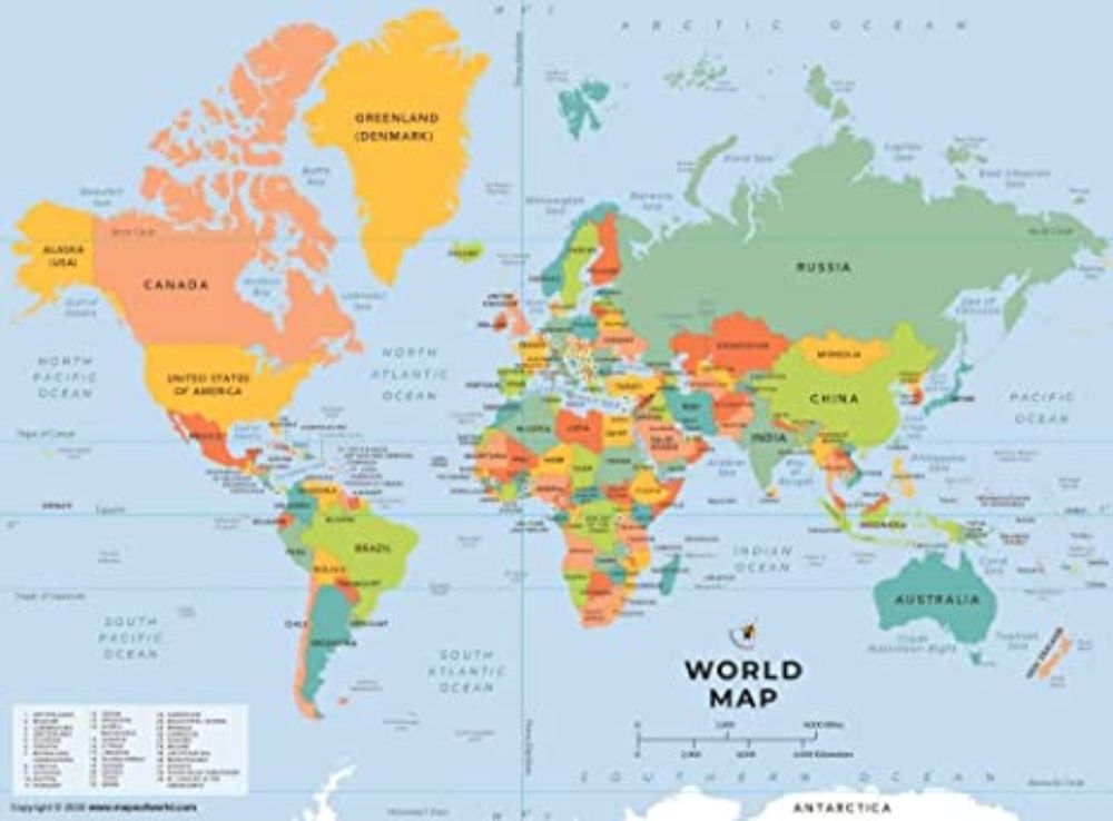
Political Map: National and state borders are shown on political maps. Contrasting colours highlight different countries and states, so the legal boundaries stand out more clearly. To aid understanding, major cities, rivers, oceans and seas are also labelled.
Political map
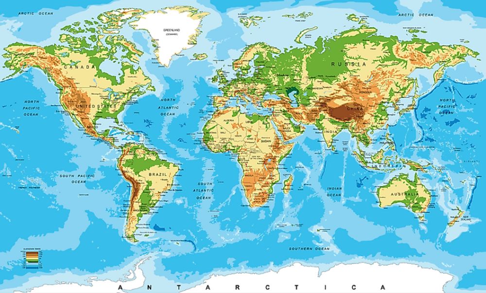
Physical Map: Permanent natural features are depicted on physical maps. Desserts, mountains, lakes, rivers and oceans are identified as well as the high and low land. Some physical maps also gives us more details like land use and soil type.
Physical map
So this is all about the variety of maps and their benefits. I believe you guys find this article useful and informative. Do like and comment.
Follow for more interesting facts and contents. Thank you…
Candlemonk | Earn By Blogging | The Bloggers Social Network | Gamified Blogging Platform
Candlemonk is a reward-driven, gamified writing and blogging platform. Blog your ideas, thoughts, knowledge and stories. Candlemonk takes your words to a bigger audience around the globe, builds a follower base for you and aids in getting the recognition and appreciation you deserve. Monetize your words and earn from your passion to write.