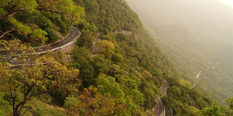
The hill town of Valparai, also known as Poonachimalai, is located in Tamil Nadu's Coimbatore district. The Anamalai Tiger Reserve is part of it; it was formerly known as the Indira Gandhi Wildlife Sanctuary and National Park (IGWLS&NP) and the Anaimalai Wildlife Sanctuary. It is situated on the Anaimalai Hills range of the Western Ghats at a height of 3,474 feet (1,059 m) above sea level. There are 56 estates in all here. Football is hugely popular in this country. Every year, contests at the state level are held. The foothill precisely begins at Monkey Falls, which is 38 km from Valparai. 40 hairpin curves make up the road from the foothills to Valparai.
The town of Malakkappara, which borders the state of Kerala, is 27 km away from Valparai. Large forest regions are still off limits even if private tea firms hold the majority of the property.
History
The first written accounts of this location date from 1846, when K. Ramasamy Mudaliyar established a coffee plantation there. The Karnatic Coffee Company started a coffee plantation here in 1864, but they were unable to turn a profit and had to sell some of their lands. Soldiers constructed the roads and lodgings in 1875 in preparation for the visit of England's Prince of Wales, the future Edward VII. Horses and elephants were utilized together with the soldiers who were stationed there. The visit was ultimately postponed.
W. Wintil and Nordan acquired a sizable parcel of property in Valparai in 1890 from the British Raj's Madras State Government. Wintil cleared the land and grew tea and coffee there. Carver Marsh, a seasoned planter, worked as his assistant for a 250 rupee wage. The entire year sees rainfall at Valparai. In Valparai, the typical temperature range is 15 °C (max) to 10 °C (min) in the winter and 25 °C (max) to 15 °C (min) in the summer.
Geography
The coordinates of Valparai are 10.37°N 76.97°E. It is a mid-elevation hill station with an average elevation of 3,914 feet (Ootacamund is somewhat higher). (1,193 m). It is close to Kerala state's Thrissur district's border.
Economy
Valparai's economy is heavily reliant on plantation crops. There are many tea and coffee estates in Valparai. The majority of the residents of this area work on these estates. To draw tourists, the Tamil Nadu government launched the construction of private resort hotels and parks in partnership with ITDC. Numerous dams and hydroelectric generating units surround Valparai. At the base of this range of mountains sits Aliyar Dam. Upper Aliyar Dam is situated off the route to Kadampaarai, which diverges from the main road to Valparai, as we ascend. The Kadamparai Dam is located in Kadamparai, and TNEB's (now TANGEDCO's) unique type of power station is situated beneath the mountain. This Kadamparai Pumped Storage's access road The massive subterranean power station complex is where the Hydro Electric Power Station breaks off around two miles earlier and travels through a tunnel. After passing through one of the dual penstocks and powering the turbine, the water from the dam is pumped up to the dam using a strong motor through the second penstock. Beyond Kadamparai, close to the Kerala border, lie the Lower Neeraar Dam and Upper Neeraar Vier.